Antibes bus map: Envibus network plan, PDF and interactive map

The official Antibes bus map is a PDF on the Envibus website, and an interactive version runs in any browser. Both are written in French, which is where many visitors get stuck: the legend says terminus, point de vente and arrêt dans un seul sens. This page translates every symbol, explains which of the twenty or so PDFs is worth downloading, and shows how to carry the map on your phone, including on a foreign SIM card. The current edition is dated September 2026. Lines, timetables and fares are covered in the guide to the Envibus network in Antibes, while this page focuses on the map and the plan.
Where to find the Antibes bus map

Envibus, the operator that runs the buses in Antibes, Biot, Vallauris and Sophia Antipolis, keeps all its maps on one plans page. It lists about twenty PDFs in four families: urban maps, school maps, local area maps and maps of the on-demand service (small buses that run when you book them, inside set zones). For a stay in Antibes, two files cover almost every need.

The full network map

The Plan Général is dated 15 June 2026 and carries the September 2026 edition. At around 11 MB it is worth downloading on Wi-Fi. It shows every town served, from Antibes, Juan-les-Pins and Biot to Cannes, Grasse and Nice airport, with the legend, a fare table and the list of ticket sales points.

The pocket diagram

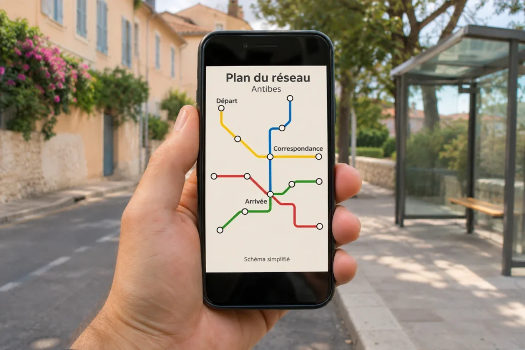
The schematic pocket map weighs about 9 MB and draws the lines in a simplified way, so connections are easy to spot at a glance. It also reproduces the town-centre plans of Antibes with walking times between stops, which suits a first look at the town.

Together the two maps give a clear idea of how the Envibus network is organised around Antibes: the full map for the big picture, the pocket diagram for a quick check on the way to a stop.

Schematic bus network map displayed on a smartphone as a PDF

Reading the French legend in English

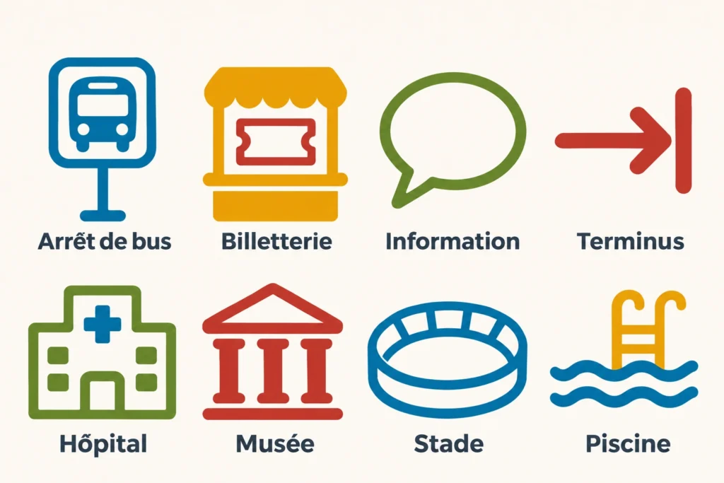
The legend on the Plan Général uses a handful of French labels. This glossary turns each one into plain English, with the practical tip that goes with it.

On the mapIn EnglishWhat to do with it
TerminusEnd of the lineCheck which direction the bus is heading
Arrêt bus dans les 2 sensStop served in both directionsUse the same stop to go and to come back
Arrêt bus dans un seul sensStop served in one direction onlyLook for the paired stop on the other side for the return
Point de vente EnvibusTicket sales pointBuy or top up before boarding
Point de rechargement EnvibusTop-up point, card paymentReload a pass near your stop
Info EnvibusInformation pointAsk about routes and tickets
Pôle d’échangesInterchangeThe bus station above Antibes railway station
Gare routièreBus stationUsed for Valbonne Sophia Antipolis, for example
Parking relaisPark and rideThe Fort Carré car park, served by a shuttle
Transport à la demandeOn-demand busBooked in advance, inside a zone

The map also scatters small pictograms for schools, hospitals, museums, town halls, stadiums, swimming pools and shopping centres. They work as landmarks: a stadium or a museum drawn next to a stop confirms that you are close to your destination.

Stop names are place names, such as Dugommier, Posidonia or Port Gallice, so they read the same in any language. Once the labels above are familiar, the map reads as easily as any other European transport plan.

Bus map legend icons: stop, ticket office, information, terminus, hospital, museum, stadium and swimming pool

The interactive map and the journey planner

When a PDF feels heavy, the interactive map on envibus.fr is a lighter way to see where each bus goes. It is built on OpenStreetMap, with the list of urban lines in a panel on the left. Each line has its own coloured disc and a route written out in full: line A is yellow, line B light blue and line 2 red. A cookie banner appears on arrival, and declining the non-essential cookies leaves the map fully usable.

Clicking a line draws its route in colour across the map, which you can zoom and drag. Try line A: the route links Antibes les Pins to Sophia Antipolis, looping around the technology park at the far end. Line 2 traces the Cap d’Antibes peninsula down to Posidonia. A second panel called Le Réseau offers two more views, Communes and Points de vente (ticket sales points).

The map answers one question: where does this line go? To work out which line to take between two addresses, Envibus has a separate journey planner page. You enter a starting point and a destination, and it returns the fastest route on the network. The line pages on the same site then give the stops and timetable for the bus you chose.

Used in this order, the map, the planner and the line pages cover the whole journey: choose a line, check it fits your plan, then read its timetable.

Interactive bus map showing colour-coded line routes on a laptop screen

The official Envibus map, displayed live from envibus.fr (in French). The cookie banner belongs to Envibus: choosing “Tout refuser” (reject all) is enough to browse the map. For a full-screen view, open the map in a new tab.
Antibes interchange and the town centre on foot

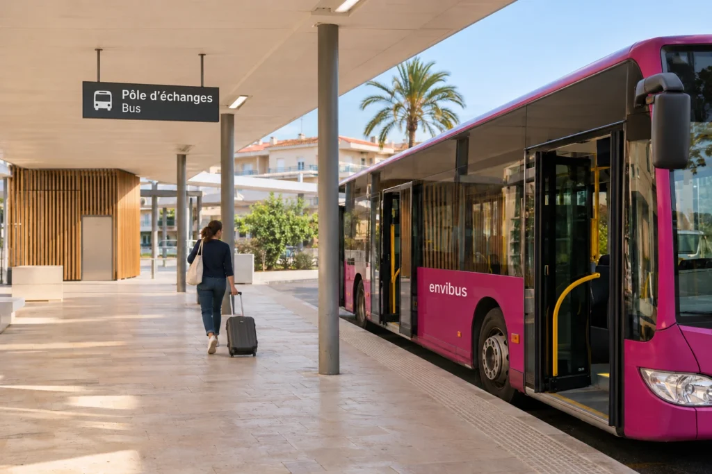
Most visitors arrive by train, and the buses wait just above the platforms. The interchange sits over Antibes station, and the station page on Gares et Connexions explains that the bus stops are reached by the footbridge. Lines A, B, 2, 9, 12, 23, 30 and 31 serve the interchange, and the platform plan published in January 2026 numbers the bays from 1 to 12 with the lines and destinations of each.

From the interchange, the town-centre stops are the next step. The town-centre plan uses place de Gaulle as its reference point and gives walking times to the nearest stops. Dugommier and Briand are one minute away, roughly 100 m and 90 m (110 and 100 yards). Place Guynemer, Diables Bleus and Soleau, and Chaudon are three minutes away, between 200 m and 250 m (220 to 275 yards). Those figures help when choosing a stop after a market morning or a long lunch.

If you want to place the interchange in the wider town, with its car parks, seafront and old ramparts, the Antibes map with stations, parking and buses shows how everything fits together at walking scale. The bus map and the town map answer different questions, and used together they let you plan a day without a car.

Traveller with a suitcase on a bay at the Antibes interchange, next to an Envibus bus

The lines worth knowing on the map

The network counts nearly thirty urban lines, but a visitor needs only a few of them. The easiest way to sort them is by what you want to do.

For the beaches and the Cap d’Antibes, line 2 runs from the interchange to Posidonia, and its stops and timetable show which one is closest to each cove. Line 15 loops from Port Gallice through Posidonia and Juan-les-Pins, and line 6 also links Port Gallice with Juan-les-Pins.

For Sophia Antipolis and its campuses, lines A and B are the two high-level-service buses, the main axes of the network with more frequent departures than ordinary lines. Line A links Antibes les Pins to the Valbonne Sophia Antipolis bus station through the interchange, and the guide to line A explains its stops and how the free pass works. Line B heads from the interchange to Saint-Philippe by way of Clausonnes. Lines 9 and 12 also reach the Valbonne bus station.

For moving around the centre, shuttle lines 14 and 16 do the rounds from place Guynemer, line 14 passing the Fort Carré park and ride and the Salis harbour, line 16 running to La Fontonne via Val Claret. Line 17 is the Vallauris shuttle. The free Pass Navette covers lines A, B, 14, 15, 16 and 17 for its holder.

The map also draws three-digit lines (620, 621, 630 and others) and line 82, heading to Nice, Cannes, Vence and Grasse. They appear to help you plan connections, yet they belong to other networks than Envibus, so their timetables and conditions come from their own operators.

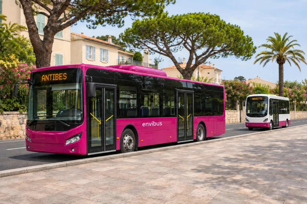
High-level-service bus and electric town-centre shuttle on an avenue in Antibes

Keeping the map on your phone

A PDF saved in your phone’s files opens offline, which is reassuring on a hillside where the mobile signal fades. Save both the Plan Général and the pocket diagram before leaving your accommodation.

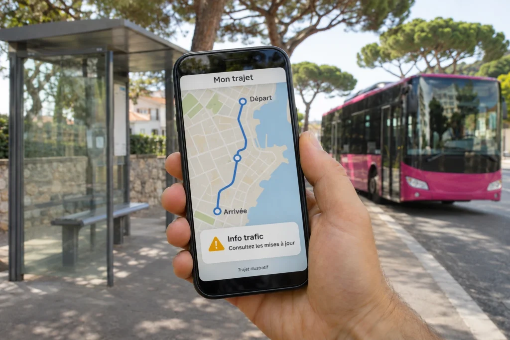
The Envibus CapAzur app adds live information to the static map. It shows the next departures of urban buses in real time, plans journeys across the Envibus network and neighbouring ones (Palmbus, Sillages, Zou! and TER trains), and lets you buy and validate a ticket on screen. It is free on iOS and Android. SNCF Connect also sells Envibus tickets, which suits travellers who already use it for trains, and a separate app called Icilà books the on-demand buses.

A foreign SIM card changes how you pay. The text-message ticket, sent as BUS plus the line number to 93006 for €1, works with plans from four French operators: Bouygues Telecom, Free, Orange and SFR. With any other SIM, the app or a ticket machine is the reliable choice. Machines stand at the Antibes interchange, Dugommier, the Azurarena, place Guynemer, Vallauris and Valbonne Sophia Antipolis.

Choosing between a €1 single, a day pass and the free Pass Navette depends on how many rides you plan, and the Envibus tickets and fares explained compare them side by side. The tourist office page on buses, trains, bikes and taxis completes the picture with the other ways of getting around.

Mobile app showing next departures and a traffic alert at a bus stop

Day trips you can plan from the map

Once the map makes sense, it becomes a menu of outings. Three combinations work well from the Antibes interchange.

A half day on the Cap d’Antibes starts with line 2, which reaches Posidonia in around 18 minutes. From there, the coastal path covers about 5 km (3 miles) of rocky shoreline, and the buses on the way back give the legs a rest. Stops such as Salis and Chemin des Ondes sit close to the beaches, so the map helps you pick where to get off.

An evening in Juan-les-Pins is easy too. Lines 30 and 31 draw loops from the interchange through Juan-les-Pins and past the Rabiac cemetery, and the train from Antibes to Juan-les-Pins takes about 3 minutes if you prefer rails. Both options leave the seafront within reach for dinner.

A day inland brings in the technology side of the Riviera. Line 10 runs from place Guynemer through Biot village to Valbonne village, while line A reaches the Valbonne Sophia Antipolis bus station in about 35 minutes. Line 23 serves La Colle-sur-Loup and Villeneuve-Loubet, and lines 5 and 8 link the centre with Vallauris, famous for its pottery.

Each of these trips begins with the same two steps: find the line on the map, then check the timetable on its page. Building a day around the last bus home keeps the plan realistic, since evening services vary from one line to the next.

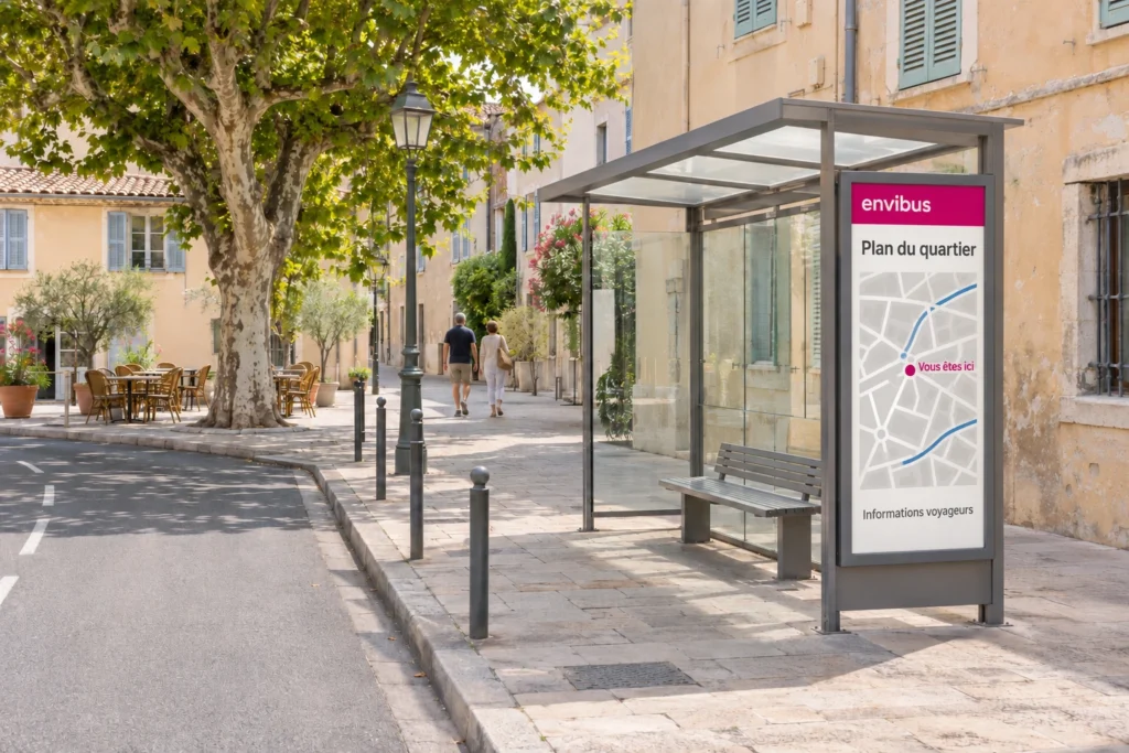
Envibus bus shelter with a neighbourhood map on a street in the centre of Antibes

Frequently asked questions about the Antibes bus map

Where can I download the Antibes bus map?

On envibus.fr, in the Le réseau section. The plans page holds the PDFs, including the Plan Général (September 2026 edition) and the schematic pocket map, and a separate page hosts the interactive map.

Is the Antibes bus map available in English?

The plans and the interactive map are published in French. The glossary above translates every label of the legend, and stop names are place names that read the same in any language.

Is there an interactive map of the Antibes buses?

Yes. It is built on OpenStreetMap: a click on a line draws its route in colour, and the Le Réseau panel adds Communes and Points de vente (ticket sales points).

Which bus goes to the Cap d’Antibes?

Line 2 runs from the Antibes interchange to Posidonia, on the Cap d’Antibes. It takes around 18 minutes, and its map shows the stops near the beaches.

Are any Antibes buses free?

The free Pass Navette covers lines A, B, 14, 15, 16 and 17 for its holder. The Plan Général also lists a free senior pass, and young children travelling with an adult ride free.

Does the map show buses to Nice airport and Cannes?

Yes, as three-digit lines such as 620 and 621, which head to Nice and Cannes. They belong to other networks than Envibus, so their timetables come from their own operators.

How do I buy a ticket with a foreign SIM card?

Use the Envibus CapAzur app, SNCF Connect or a ticket machine at the interchange, Dugommier, the Azurarena or place Guynemer. The text-message ticket works with plans from Bouygues Telecom, Free, Orange and SFR.